Little Pend Oreille National Wildlife Refuge
The Site
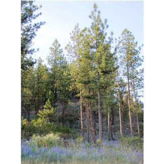
The glaciated plateau east of Colville, drained by the Little Pend Oreille River, has many marshes, lakes, and small streams. The first ridges of the Selkirks rise to the east. The 40,000-acre Little Pend Oreille National Wildlife Refuge embraces a generous cross-section of these habitats. Dry forest of Douglas fir and Ponderosa pine at 1,800 feet gives way to subalpine fir approaching the crest of the mountains at 5,600 feet.
The Birds
Lakes, ponds, and adjacent marshes host nesting ducks, Red-necked Grebe, rails, Willow Flycatcher, Marsh Wren, and Common Yellowthroat. Open forests, meadows, and streamside vegetation at lower elevations have a wide array of flycatchers and songbirds, including ''eastern'' species such as Gray Catbird, American Redstart, and Northern Waterthrush. Moose are seen frequently. Look also for Ruffed Grouse and Wild Turkey, and for White-headed Woodpecker in the ponderosa pines. Listen for Flammulated Owl at night.
Roads into the upper elevations (above 3,600 feet) will bring you into wet forests of Engelmann spruce, western red cedar, western larch, and lodgepole pine. Here you may find nesting species such as Spruce Grouse, American Three-toed Woodpecker, Hammond's Flycatcher, Cassin's and Warbling Vireos, Mountain and Chestnut-backed Chickadees, Swainson's and Varied Thrushes, Yellow-rumped and Townsend's Warblers, Dark-eyed Junco, and Red Crossbill. Outside the refuge, explore lake, wetland, and forest habitats along side-roads, as SR-20 continues eastward toward Tiger through similar country.
Directions and Suggestions
Look for a brown refuge sign along SR-20 about six miles east of Colville. Go south here on Artman-Gibson Road. In about 1.5 miles, turn left onto Kitt-Narcisse Road, then right onto Bear Creek Road in about two more miles. Refuge headquarters is on your right about three miles from this intersection. Stop here for a map.
Some of the many fine birding spots include Horse Thief Lake and marsh, about two miles back from headquarters on Bear Creek Road; Cottonwood Campground, a mile farther into the refuge from headquarters on this same road; Potter's Pond (turn off right from Bear Creek Road three miles beyond Cottonwood Campground); Rookery Road (directly across Bear Creek Road from Potter's Pond turnoff), and Blacktail Mountain Road into the high country. Another excellent route across high, wet-forest habitats is Tacoma Creek Road. The turnoff for this gravel road is about 15 miles farther east on SR-20 from the Artman-Gibson Road intersection. You may drive it some twenty miles, to where it rejoins SR-20 near Cusick.
Roads are open to headquarters year round. Internal refuge roads are mostly gated and closed in winter, although you may walk or ski in. Rookery Road is closed to vehicular traffic during the nesting season.

